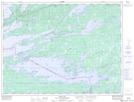
Maps showing Big Dry Island, Rainy River, Ontario
Big Dry Island is a Island located in Rainy River, Ontario and has an elevation of 346 meters.
- Latitude: 48° 33' 32'' North (decimal: 48.5588888)
- Longitude: 92° 41' 34'' West (decimal: -92.6927777)
- Topography Feature Category: Island
- Geographical Feature: Island
- Canadian Province/Territory: Ontario
- Elevation: 346 meters
- Location: Rainy River
- Atlas of Canada Locator Map: Big Dry Island
- GPS Coordinate Locator Map: Big Dry Island Lat/Long
Big Dry Island NTS Map Sheets