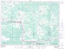
Maps showing Big Fork, Rainy River, Ontario
Big Fork is a Unincorporated area located in Rainy River, Ontario and has an elevation of 336 meters.
- Latitude: 48° 31' 18'' North (decimal: 48.5216666)
- Longitude: 93° 40' 20'' West (decimal: -93.6722222)
- Topography Feature Category: Unincorporated area
- Geographical Feature: Dispersed Rural Community
- Canadian Province/Territory: Ontario
- Elevation: 336 meters
- Location: Rainy River
- Atlas of Canada Locator Map: Big Fork
- GPS Coordinate Locator Map: Big Fork Lat/Long
Big Fork NTS Map Sheets