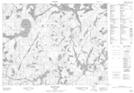
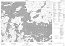
Maps showing Big Island, Kenora, Ontario
Big Island is a Island located in Kenora, Ontario.
- Latitude: 50° 15' 26'' North (decimal: 50.2572222)
- Longitude: 92° 35' 57'' West (decimal: -92.5991666)
- Topography Feature Category: Island
- Geographical Feature: Island
- Canadian Province/Territory: Ontario
- Location: Kenora
- Atlas of Canada Locator Map: Big Island
- GPS Coordinate Locator Map: Big Island Lat/Long
Big Island NTS Map Sheets