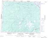
Maps showing Biglow Creek, Cochrane, Ontario
Biglow Creek is a River located in Cochrane, Ontario.
- Latitude: 52° 5' 45'' North (decimal: 52.0958333)
- Longitude: 82° 13' 21'' West (decimal: -82.2225000)
- Topography Feature Category: River
- Geographical Feature: Creek
- Canadian Province/Territory: Ontario
- Location: Cochrane
- Atlas of Canada Locator Map: Biglow Creek
- GPS Coordinate Locator Map: Biglow Creek Lat/Long
Biglow Creek NTS Map Sheets