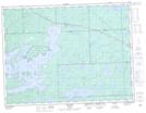
Maps showing Biota, Thunder Bay, Ontario
Biota is a Unincorporated area located in Thunder Bay, Ontario.
- Latitude: 48° 59' 22'' North (decimal: 48.9894444)
- Longitude: 90° 22' 53'' West (decimal: -90.3813888)
- Topography Feature Category: Unincorporated area
- Geographical Feature: Railway Point
- Canadian Province/Territory: Ontario
- Location: Thunder Bay
- Atlas of Canada Locator Map: Biota
- GPS Coordinate Locator Map: Biota Lat/Long