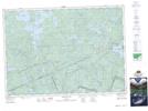
Maps showing Bittern Marsh, Nipissing, Ontario
Bittern Marsh is a Low vegetation located in Nipissing, Ontario and has an elevation of 433 meters.
- Latitude: 45° 34' 22'' North (decimal: 45.5727777)
- Longitude: 78° 20' 37'' West (decimal: -78.3436111)
- Topography Feature Category: Low vegetation
- Geographical Feature: Marsh
- Canadian Province/Territory: Ontario
- Elevation: 433 meters
- Location: Nipissing
- Atlas of Canada Locator Map: Bittern Marsh
- GPS Coordinate Locator Map: Bittern Marsh Lat/Long
Bittern Marsh NTS Map Sheets