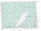
Maps showing Black Trout Creek, Algoma, Ontario
Black Trout Creek is a River located in Algoma, Ontario and has an elevation of 295 meters.
- Latitude: 48° 2' 10'' North (decimal: 48.0361111)
- Longitude: 84° 49' 29'' West (decimal: -84.8247222)
- Topography Feature Category: River
- Geographical Feature: Creek
- Canadian Province/Territory: Ontario
- Elevation: 295 meters
- Location: Algoma
- Atlas of Canada Locator Map: Black Trout Creek
- GPS Coordinate Locator Map: Black Trout Creek Lat/Long
Black Trout Creek NTS Map Sheets