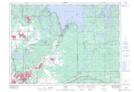
Maps showing Boland's Bay, Sudbury, Ontario
Boland's Bay is a Unincorporated area located in Sudbury, Ontario and has an elevation of 293 meters.
- Latitude: 46° 39' 11'' North (decimal: 46.6530555)
- Longitude: 80° 45' 59'' West (decimal: -80.7663888)
- Topography Feature Category: Unincorporated area
- Geographical Feature: Dispersed Rural Community
- Canadian Province/Territory: Ontario
- Elevation: 293 meters
- Location: Sudbury
- Atlas of Canada Locator Map: Boland's Bay
- GPS Coordinate Locator Map: Boland's Bay Lat/Long