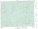
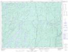
Maps showing Boomerang Lake, Thunder Bay, Ontario
Boomerang Lake is a Lake located in Thunder Bay, Ontario and has an elevation of 329 meters.
- Latitude: 49° 16' 17'' North (decimal: 49.2713888)
- Longitude: 86° 22' 31'' West (decimal: -86.3752777)
- Topography Feature Category: Lake
- Geographical Feature: Lake
- Canadian Province/Territory: Ontario
- Elevation: 329 meters
- Location: Thunder Bay
- Atlas of Canada Locator Map: Boomerang Lake
- GPS Coordinate Locator Map: Boomerang Lake Lat/Long
Boomerang Lake NTS Map Sheets