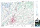
Maps showing Botulf Siding, Peterborough, Ontario
Botulf Siding is a Unincorporated area located in Peterborough, Ontario.
- Latitude: 44° 18' North (decimal: 44.3000000)
- Longitude: 78° 18' West (decimal: -78.3000000)
- Topography Feature Category: Unincorporated area
- Geographical Feature: Railway Point
- Canadian Province/Territory: Ontario
- Location: Peterborough
- GPS Coordinate Locator Map: Botulf Siding Lat/Long
Botulf Siding NTS Map Sheets