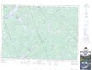
Maps showing Boundary Creek, Lanark; Renfrew, Ontario
Boundary Creek is a River located in Lanark; Renfrew, Ontario and has an elevation of 183 meters.
- Latitude: 45° 15' 10'' North (decimal: 45.2527777)
- Longitude: 76° 36' 12'' West (decimal: -76.6033333)
- Topography Feature Category: River
- Geographical Feature: Creek
- Canadian Province/Territory: Ontario
- Elevation: 183 meters
- Location: Lanark; Renfrew
- Atlas of Canada Locator Map: Boundary Creek
- GPS Coordinate Locator Map: Boundary Creek Lat/Long
Boundary Creek NTS Map Sheets