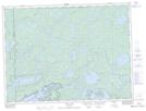
Maps showing Boundary Point, Rainy River, Ontario
Boundary Point is a Cape located in Rainy River, Ontario and has an elevation of 424 meters.
- Latitude: 48° 18' 10'' North (decimal: 48.3027777)
- Longitude: 90° 57' 59'' West (decimal: -90.9663888)
- Topography Feature Category: Cape
- Geographical Feature: Point
- Canadian Province/Territory: Ontario
- Elevation: 424 meters
- Location: Rainy River
- Atlas of Canada Locator Map: Boundary Point
- GPS Coordinate Locator Map: Boundary Point Lat/Long