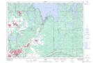
Maps showing Bowlands Bay, Ontario
Bowlands Bay is a Unincorporated area located in Ontario.
- Latitude: 46° 39' North (decimal: 46.6500000)
- Longitude: 80° 46' West (decimal: -80.7666999)
- Topography Feature Category: Unincorporated area
- Geographical Feature: Dispersed Rural Community
- Canadian Province/Territory: Ontario
- GPS Coordinate Locator Map: Bowlands Bay Lat/Long