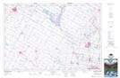
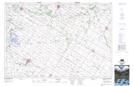
Maps showing Boyle Drain, Huron, Ontario
Boyle Drain is a Hydraulic construction located in Huron, Ontario and has an elevation of 369 meters.
- Latitude: 43° 42' 17'' North (decimal: 43.7047222)
- Longitude: 81° 6' 1'' West (decimal: -81.1002777)
- Topography Feature Category: Hydraulic construction
- Geographical Feature: Drain
- Canadian Province/Territory: Ontario
- Elevation: 369 meters
- Location: Huron
- Atlas of Canada Locator Map: Boyle Drain
- GPS Coordinate Locator Map: Boyle Drain Lat/Long
Boyle Drain NTS Map Sheets