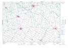
Maps showing Brandy Creek, Wellington, Ontario
Brandy Creek is a River located in Wellington, Ontario and has an elevation of 442 meters.
- Latitude: 43° 49' 21'' North (decimal: 43.8224999)
- Longitude: 80° 31' 15'' West (decimal: -80.5208333)
- Topography Feature Category: River
- Geographical Feature: Creek
- Canadian Province/Territory: Ontario
- Elevation: 442 meters
- Location: Wellington
- Atlas of Canada Locator Map: Brandy Creek
- GPS Coordinate Locator Map: Brandy Creek Lat/Long
Brandy Creek NTS Map Sheets