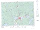
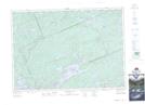
Maps showing Bravender Creek, Muskoka, Ontario
Bravender Creek is a River located in Muskoka, Ontario and has an elevation of 389 meters.
- Latitude: 45° 25' 58'' North (decimal: 45.4327777)
- Longitude: 79° 0' 38'' West (decimal: -79.0105555)
- Topography Feature Category: River
- Geographical Feature: Creek
- Canadian Province/Territory: Ontario
- Elevation: 389 meters
- Location: Muskoka
- Atlas of Canada Locator Map: Bravender Creek
- GPS Coordinate Locator Map: Bravender Creek Lat/Long
Bravender Creek NTS Map Sheets