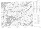
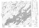
Maps showing Brodribb Bay, Thunder Bay, Ontario
Brodribb Bay is a Bay located in Thunder Bay, Ontario and has an elevation of 391 meters.
- Latitude: 51° 1' 44'' North (decimal: 51.0288888)
- Longitude: 90° 42' 17'' West (decimal: -90.7047222)
- Topography Feature Category: Bay
- Geographical Feature: Bay
- Canadian Province/Territory: Ontario
- Elevation: 391 meters
- Location: Thunder Bay
- Atlas of Canada Locator Map: Brodribb Bay
- GPS Coordinate Locator Map: Brodribb Bay Lat/Long
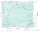
Brodribb Bay NTS Map Sheets