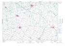
Maps showing Brotherston, Perth, Ontario
Brotherston is a Unincorporated area located in Perth, Ontario and has an elevation of 372 meters.
- Latitude: 43° 49' 10'' North (decimal: 43.8194444)
- Longitude: 80° 57' 44'' West (decimal: -80.9622222)
- Topography Feature Category: Unincorporated area
- Geographical Feature: Compact Rural Community
- Canadian Province/Territory: Ontario
- Elevation: 372 meters
- Location: Perth
- Atlas of Canada Locator Map: Brotherston
- GPS Coordinate Locator Map: Brotherston Lat/Long
Brotherston NTS Map Sheets