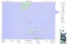
Maps showing Brown Ledge, Parry Sound, Ontario
Brown Ledge is a Shoal located in Parry Sound, Ontario.
- Latitude: 45° 17' 00'' North (decimal: 45.2833333)
- Longitude: 81° 33' 48'' West (decimal: -81.5633333)
- Topography Feature Category: Shoal
- Geographical Feature: Ledge
- Canadian Province/Territory: Ontario
- Location: Parry Sound
- Atlas of Canada Locator Map: Brown Ledge
- GPS Coordinate Locator Map: Brown Ledge Lat/Long
Brown Ledge NTS Map Sheets