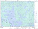
Maps showing Browns Inlet, Rainy River, Ontario
Browns Inlet is a Bay located in Rainy River, Ontario and has an elevation of 344 meters.
- Latitude: 48° 47' 58'' North (decimal: 48.7994444)
- Longitude: 93° 25' 59'' West (decimal: -93.4330555)
- Topography Feature Category: Bay
- Geographical Feature: Inlet
- Canadian Province/Territory: Ontario
- Elevation: 344 meters
- Location: Rainy River
- Atlas of Canada Locator Map: Browns Inlet
- GPS Coordinate Locator Map: Browns Inlet Lat/Long
Browns Inlet NTS Map Sheets