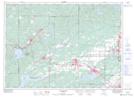
Maps showing Azilda, Sudbury, Ontario
Azilda is a Unincorporated area located in Sudbury, Ontario and has an elevation of 276 meters.
- Latitude: 46° 33' 00'' North (decimal: 46.5499999)
- Longitude: 81° 6' 52'' West (decimal: -81.1144444)
- Topography Feature Category: Unincorporated area
- Geographical Feature: Compact Rural Community
- Canadian Province/Territory: Ontario
- Elevation: 276 meters
- Location: Sudbury
- Atlas of Canada Locator Map: Azilda
- GPS Coordinate Locator Map: Azilda Lat/Long