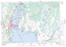
Maps showing Buena Vista Park, Simcoe, Ontario
Buena Vista Park is a Unincorporated area located in Simcoe, Ontario and has an elevation of 217 meters.
- Latitude: 44° 42' 23'' North (decimal: 44.7063888)
- Longitude: 79° 23' 9'' West (decimal: -79.3858333)
- Topography Feature Category: Unincorporated area
- Geographical Feature: Suburban Community
- Canadian Province/Territory: Ontario
- Elevation: 217 meters
- Location: Simcoe
- Atlas of Canada Locator Map: Buena Vista Park
- GPS Coordinate Locator Map: Buena Vista Park Lat/Long
Buena Vista Park NTS Map Sheets