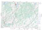
Maps showing Buller Siding, Hastings, Ontario
Buller Siding is a Unincorporated area located in Hastings, Ontario.
- Latitude: 44° 26' 54'' North (decimal: 44.4483333)
- Longitude: 77° 22' 32'' West (decimal: -77.3755555)
- Topography Feature Category: Unincorporated area
- Geographical Feature: Dispersed Rural Community
- Canadian Province/Territory: Ontario
- Location: Hastings
- Atlas of Canada Locator Map: Buller Siding
- GPS Coordinate Locator Map: Buller Siding Lat/Long