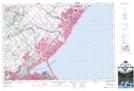
Maps showing Burlington Canal, Halton, Ontario
Burlington Canal is a Marine navigation feature located in Halton, Ontario and has an elevation of 74 meters.
- Latitude: 43° 17' 56'' North (decimal: 43.2988888)
- Longitude: 79° 47' 45'' West (decimal: -79.7958333)
- Topography Feature Category: Marine navigation feature
- Geographical Feature: Canal
- Canadian Province/Territory: Ontario
- Elevation: 74 meters
- Location: Halton
- Atlas of Canada Locator Map: Burlington Canal
- GPS Coordinate Locator Map: Burlington Canal Lat/Long
Burlington Canal NTS Map Sheets