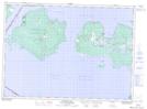
Maps showing Burnt Cove, Manitoulin, Ontario
Burnt Cove is a Bay located in Manitoulin, Ontario and has an elevation of 180 meters.
- Latitude: 45° 59' 29'' North (decimal: 45.9913888)
- Longitude: 83° 21' 7'' West (decimal: -83.3519444)
- Topography Feature Category: Bay
- Geographical Feature: Cove
- Canadian Province/Territory: Ontario
- Elevation: 180 meters
- Location: Manitoulin
- Atlas of Canada Locator Map: Burnt Cove
- GPS Coordinate Locator Map: Burnt Cove Lat/Long