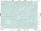
Maps showing Calder Lake, Kenora, Ontario
Calder Lake is a Lake located in Kenora, Ontario and has an elevation of 396 meters.
- Latitude: 49° 14' 19'' North (decimal: 49.2386111)
- Longitude: 93° 6' 26'' West (decimal: -93.1072222)
- Topography Feature Category: Lake
- Geographical Feature: Lake
- Canadian Province/Territory: Ontario
- Elevation: 396 meters
- Location: Kenora
- Atlas of Canada Locator Map: Calder Lake
- GPS Coordinate Locator Map: Calder Lake Lat/Long