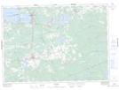
Maps showing Callander, Parry Sound, Ontario
Callander is a Unincorporated area located in Parry Sound, Ontario and has an elevation of 210 meters.
- Latitude: 46° 13' 24'' North (decimal: 46.2233333)
- Longitude: 79° 21' 53'' West (decimal: -79.3647222)
- Topography Feature Category: Unincorporated area
- Geographical Feature: Compact Rural Community
- Canadian Province/Territory: Ontario
- Elevation: 210 meters
- Location: Parry Sound
- Atlas of Canada Locator Map: Callander
- GPS Coordinate Locator Map: Callander Lat/Long