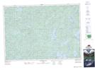
Maps showing Calumet Lake, Nipissing, Ontario
Calumet Lake is a Lake located in Nipissing, Ontario and has an elevation of 402 meters.
- Latitude: 45° 53' 18'' North (decimal: 45.8883333)
- Longitude: 78° 33' 27'' West (decimal: -78.5574999)
- Topography Feature Category: Lake
- Geographical Feature: Lake
- Canadian Province/Territory: Ontario
- Elevation: 402 meters
- Location: Nipissing
- Atlas of Canada Locator Map: Calumet Lake
- GPS Coordinate Locator Map: Calumet Lake Lat/Long
Calumet Lake NTS Map Sheets