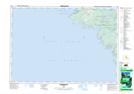
Maps showing Campbell Reef, Bruce, Ontario
Campbell Reef is a Shoal located in Bruce, Ontario.
- Latitude: 45° 8' 32'' North (decimal: 45.1422222)
- Longitude: 81° 37' 1'' West (decimal: -81.6169444)
- Topography Feature Category: Shoal
- Geographical Feature: Reef
- Canadian Province/Territory: Ontario
- Location: Bruce
- Atlas of Canada Locator Map: Campbell Reef
- GPS Coordinate Locator Map: Campbell Reef Lat/Long
Campbell Reef NTS Map Sheets