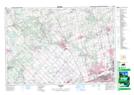
Maps showing Campbells Cross, Peel, Ontario
Campbells Cross is a Unincorporated area located in Peel, Ontario and has an elevation of 284 meters.
- Latitude: 43° 47' 2'' North (decimal: 43.7838888)
- Longitude: 79° 52' 1'' West (decimal: -79.8669444)
- Topography Feature Category: Unincorporated area
- Geographical Feature: Dispersed Rural Community
- Canadian Province/Territory: Ontario
- Elevation: 284 meters
- Location: Peel
- Atlas of Canada Locator Map: Campbells Cross
- GPS Coordinate Locator Map: Campbells Cross Lat/Long