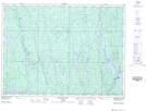
Maps showing Camp Kenogaming, Sudbury, Ontario
Camp Kenogaming is a Unincorporated area located in Sudbury, Ontario and has an elevation of 391 meters.
- Latitude: 47° 58' 13'' North (decimal: 47.9702777)
- Longitude: 81° 56' 37'' West (decimal: -81.9436111)
- Topography Feature Category: Unincorporated area
- Geographical Feature: Railway Point
- Canadian Province/Territory: Ontario
- Elevation: 391 meters
- Location: Sudbury
- Atlas of Canada Locator Map: Camp Kenogaming
- GPS Coordinate Locator Map: Camp Kenogaming Lat/Long
Camp Kenogaming NTS Map Sheets