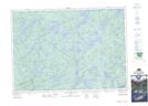
Maps showing Camp Pathfinder, Nipissing, Ontario
Camp Pathfinder is a Unincorporated area located in Nipissing, Ontario.
- Latitude: 45° 33' North (decimal: 45.5500000)
- Longitude: 78° 39' West (decimal: -78.6500000)
- Topography Feature Category: Unincorporated area
- Geographical Feature: Station
- Canadian Province/Territory: Ontario
- Location: Nipissing
- GPS Coordinate Locator Map: Camp Pathfinder Lat/Long
Camp Pathfinder NTS Map Sheets