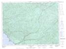
Maps showing Pointe La Canadienne, Thunder Bay, Ontario
Pointe La Canadienne is a Cape located in Thunder Bay, Ontario and has an elevation of 193 meters.
- Latitude: 48° 1' 22'' North (decimal: 48.0227777)
- Longitude: 85° 56' 29'' West (decimal: -85.9413888)
- Topography Feature Category: Cape
- Geographical Feature: Pointe
- Canadian Province/Territory: Ontario
- Elevation: 193 meters
- Location: Thunder Bay
- Atlas of Canada Locator Map: Pointe La Canadienne
- GPS Coordinate Locator Map: Pointe La Canadienne Lat/Long
Pointe La Canadienne NTS Map Sheets