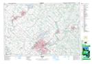
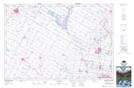
Maps showing Canagagigue Creek, Waterloo; Wellington, Ontario
Canagagigue Creek is a River located in Waterloo; Wellington, Ontario and has an elevation of 341 meters.
- Latitude: 43° 34' 26'' North (decimal: 43.5738888)
- Longitude: 80° 29' 25'' West (decimal: -80.4902777)
- Topography Feature Category: River
- Geographical Feature: Creek
- Canadian Province/Territory: Ontario
- Elevation: 341 meters
- Location: Waterloo; Wellington
- Atlas of Canada Locator Map: Canagagigue Creek
- GPS Coordinate Locator Map: Canagagigue Creek Lat/Long
Canagagigue Creek NTS Map Sheets