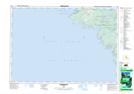
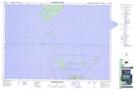
Maps showing Cape Hurd Channel, Bruce, Ontario
Cape Hurd Channel is a Channel located in Bruce, Ontario and has an elevation of 177 meters.
- Latitude: 45° 15' 27'' North (decimal: 45.2574999)
- Longitude: 81° 41' 36'' West (decimal: -81.6933333)
- Topography Feature Category: Channel
- Geographical Feature: Channel
- Canadian Province/Territory: Ontario
- Elevation: 177 meters
- Location: Bruce
- Atlas of Canada Locator Map: Cape Hurd Channel
- GPS Coordinate Locator Map: Cape Hurd Channel Lat/Long
Cape Hurd Channel NTS Map Sheets