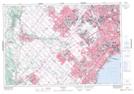
Maps showing Carolyn Creek, Peel, Ontario
Carolyn Creek is a River located in Peel, Ontario and has an elevation of 152 meters.
- Latitude: 43° 34' 23'' North (decimal: 43.5730555)
- Longitude: 79° 41' 34'' West (decimal: -79.6927777)
- Topography Feature Category: River
- Geographical Feature: Creek
- Canadian Province/Territory: Ontario
- Elevation: 152 meters
- Location: Peel
- Atlas of Canada Locator Map: Carolyn Creek
- GPS Coordinate Locator Map: Carolyn Creek Lat/Long