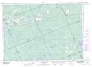
Maps showing Cedar Creek, Parry Sound, Ontario
Cedar Creek is a River located in Parry Sound, Ontario and has an elevation of 300 meters.
- Latitude: 45° 51' 4'' North (decimal: 45.8511111)
- Longitude: 79° 41' 55'' West (decimal: -79.6986111)
- Topography Feature Category: River
- Geographical Feature: Creek
- Canadian Province/Territory: Ontario
- Elevation: 300 meters
- Location: Parry Sound
- Atlas of Canada Locator Map: Cedar Creek
- GPS Coordinate Locator Map: Cedar Creek Lat/Long
Cedar Creek NTS Map Sheets