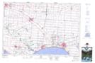
Maps showing Cedar Creek, Essex, Ontario
Cedar Creek is a River located in Essex, Ontario and has an elevation of 175 meters.
- Latitude: 42° 0' 37'' North (decimal: 42.0102777)
- Longitude: 82° 46' 44'' West (decimal: -82.7788888)
- Topography Feature Category: River
- Geographical Feature: Creek
- Canadian Province/Territory: Ontario
- Elevation: 175 meters
- Location: Essex
- Atlas of Canada Locator Map: Cedar Creek
- GPS Coordinate Locator Map: Cedar Creek Lat/Long