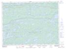
Maps showing Cedar Portage, Rainy River, Ontario
Cedar Portage is a Road feature located in Rainy River, Ontario and has an elevation of 412 meters.
- Latitude: 48° 34' 30'' North (decimal: 48.5750000)
- Longitude: 91° 39' 45'' West (decimal: -91.6625000)
- Topography Feature Category: Road feature
- Geographical Feature: Portage
- Canadian Province/Territory: Ontario
- Elevation: 412 meters
- Location: Rainy River
- Atlas of Canada Locator Map: Cedar Portage
- GPS Coordinate Locator Map: Cedar Portage Lat/Long
Cedar Portage NTS Map Sheets