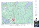
Maps showing Cedar Village, Muskoka, Ontario
Cedar Village is a Unincorporated area located in Muskoka, Ontario and has an elevation of 243 meters.
- Latitude: 45° 3' 6'' North (decimal: 45.0516666)
- Longitude: 79° 23' 21'' West (decimal: -79.3891666)
- Topography Feature Category: Unincorporated area
- Geographical Feature: Dispersed Rural Community
- Canadian Province/Territory: Ontario
- Elevation: 243 meters
- Location: Muskoka
- Atlas of Canada Locator Map: Cedar Village
- GPS Coordinate Locator Map: Cedar Village Lat/Long
Cedar Village NTS Map Sheets