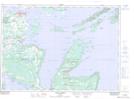
Maps showing Centre Island Bank, Manitoulin, Ontario
Centre Island Bank is a Shoal located in Manitoulin, Ontario.
- Latitude: 45° 55' 39'' North (decimal: 45.9275000)
- Longitude: 81° 39' 30'' West (decimal: -81.6583333)
- Topography Feature Category: Shoal
- Geographical Feature: Bank
- Canadian Province/Territory: Ontario
- Location: Manitoulin
- Atlas of Canada Locator Map: Centre Island Bank
- GPS Coordinate Locator Map: Centre Island Bank Lat/Long
Centre Island Bank NTS Map Sheets