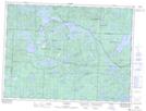
Maps showing Chagnon Lake, Sudbury, Ontario
Chagnon Lake is a Lake located in Sudbury, Ontario and has an elevation of 476 meters.
- Latitude: 47° 53' 12'' North (decimal: 47.8866666)
- Longitude: 83° 30' 27'' West (decimal: -83.5074999)
- Topography Feature Category: Lake
- Geographical Feature: Lake
- Canadian Province/Territory: Ontario
- Elevation: 476 meters
- Location: Sudbury
- Atlas of Canada Locator Map: Chagnon Lake
- GPS Coordinate Locator Map: Chagnon Lake Lat/Long