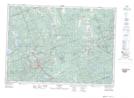
Maps showing The Chain Lakes, Hastings, Ontario
The Chain Lakes is a Lake located in Hastings, Ontario and has an elevation of 360 meters.
- Latitude: 45° 0' 23'' North (decimal: 45.0063888)
- Longitude: 77° 37' 25'' West (decimal: -77.6236111)
- Topography Feature Category: Lake
- Geographical Feature: Lakes
- Canadian Province/Territory: Ontario
- Elevation: 360 meters
- Location: Hastings
- Atlas of Canada Locator Map: The Chain Lakes
- GPS Coordinate Locator Map: The Chain Lakes Lat/Long