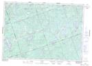
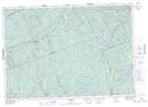
Maps showing Chandos Lake, Peterborough, Ontario
Chandos Lake is a Lake located in Peterborough, Ontario and has an elevation of 332 meters.
- Latitude: 44° 49' 30'' North (decimal: 44.8249999)
- Longitude: 77° 58' 43'' West (decimal: -77.9786111)
- Topography Feature Category: Lake
- Geographical Feature: Lake
- Canadian Province/Territory: Ontario
- Elevation: 332 meters
- Location: Peterborough
- Atlas of Canada Locator Map: Chandos Lake
- GPS Coordinate Locator Map: Chandos Lake Lat/Long
Chandos Lake NTS Map Sheets