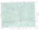
Maps showing Chant Plain Lake, Nipissing, Ontario
Chant Plain Lake is a Lake located in Nipissing, Ontario and has an elevation of 187 meters.
- Latitude: 46° 18' 49'' North (decimal: 46.3136111)
- Longitude: 78° 46' 29'' West (decimal: -78.7747222)
- Topography Feature Category: Lake
- Geographical Feature: Lake
- Canadian Province/Territory: Ontario
- Elevation: 187 meters
- Location: Nipissing
- Atlas of Canada Locator Map: Chant Plain Lake
- GPS Coordinate Locator Map: Chant Plain Lake Lat/Long