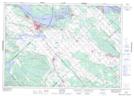
Maps showing Chats Haven, Renfrew, Ontario
Chats Haven is a Unincorporated area located in Renfrew, Ontario and has an elevation of 84 meters.
- Latitude: 45° 26' 6'' North (decimal: 45.4350000)
- Longitude: 76° 20' 35'' West (decimal: -76.3430555)
- Topography Feature Category: Unincorporated area
- Geographical Feature: Urban Community
- Canadian Province/Territory: Ontario
- Elevation: 84 meters
- Location: Renfrew
- Atlas of Canada Locator Map: Chats Haven
- GPS Coordinate Locator Map: Chats Haven Lat/Long