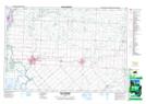
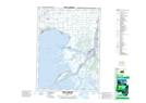
Maps showing Chenail Ecarté (The Snye), Kent; Lambton, Ontario
Chenail Ecarté (The Snye) is a River located in Kent; Lambton, Ontario and has an elevation of 178 meters.
- Latitude: 42° 28' North (decimal: 42.4666666)
- Longitude: 82° 29' West (decimal: -82.4833333)
- Topography Feature Category: River
- Geographical Feature: River
- Canadian Province/Territory: Ontario
- Elevation: 178 meters
- Location: Kent; Lambton
- Atlas of Canada Locator Map: Chenail Ecarté (The Snye)
- GPS Coordinate Locator Map: Chenail Ecarté (The Snye) Lat/Long
Chenail Ecarté (The Snye) NTS Map Sheets