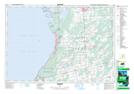
Maps showing Chiefs Point Bay, Bruce, Ontario
Chiefs Point Bay is a Bay located in Bruce, Ontario and has an elevation of 176 meters.
- Latitude: 44° 41' 55'' North (decimal: 44.6986111)
- Longitude: 81° 17' 00'' West (decimal: -81.2833333)
- Topography Feature Category: Bay
- Geographical Feature: Bay
- Canadian Province/Territory: Ontario
- Elevation: 176 meters
- Location: Bruce
- Atlas of Canada Locator Map: Chiefs Point Bay
- GPS Coordinate Locator Map: Chiefs Point Bay Lat/Long