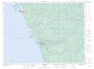
Maps showing Chigamiwinigum Portage, Thunder Bay, Ontario
Chigamiwinigum Portage is a Road feature located in Thunder Bay, Ontario and has an elevation of 221 meters.
- Latitude: 48° 33' 40'' North (decimal: 48.5611111)
- Longitude: 86° 13' 56'' West (decimal: -86.2322222)
- Topography Feature Category: Road feature
- Geographical Feature: Portage
- Canadian Province/Territory: Ontario
- Elevation: 221 meters
- Location: Thunder Bay
- Atlas of Canada Locator Map: Chigamiwinigum Portage
- GPS Coordinate Locator Map: Chigamiwinigum Portage Lat/Long