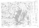
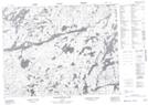
Maps showing Chivelston Lake, Thunder Bay, Ontario
Chivelston Lake is a Lake located in Thunder Bay, Ontario.
- Latitude: 50° 14' 46'' North (decimal: 50.2461111)
- Longitude: 90° 40' 19'' West (decimal: -90.6719444)
- Topography Feature Category: Lake
- Geographical Feature: Lake
- Canadian Province/Territory: Ontario
- Location: Thunder Bay
- Atlas of Canada Locator Map: Chivelston Lake
- GPS Coordinate Locator Map: Chivelston Lake Lat/Long
Chivelston Lake NTS Map Sheets